|
|
|
|
|
|||||||||||||||
Oil and Gas Specialist - Worldwide Consultant - 32 years experience - Based in Denver, Colorado |
303.726.5663
(Cell) |
|||||||||||||||||
|
|
|
|
|
|||||||||||||||
|
303.726.5663 (Cell) |
|
|
||||||||||||||||
|
Madden Prospect Philp Sheep
Ranch
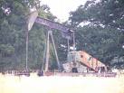
The Philp Sheep Company lease is located in Sections 7,18-T39N-R90W within the Madden Unit Area. Structural mapping utilizing subsurface data at the top of the Lance indicates that the proposed location will test a possible fault trap on the north flank of the Madden Unit. The Lower Ft. Union and Lance Formations are gas saturated yet only sparsely tested in this area of the unit. Review of the available seismic data in the area indicates the presence of a potential fault bounded closure en echelon to the Madden anticline. Review of aerial photo map data indicate a deep seated structural feature north of the Shelter No. 1-19. Correlation of individual sands in the fluvial section of the Lower Ft. Union and Lance is impossible even at 40 acre spacing. Gas recoveries indicate the presence of a much larger gas reservoir. Natural fractures associated with east-west trending faults and vertical and lateral variations in sandstone deposition have compartmentalized a large gas accumulation along the north flank of the Madden anticline. Monsanto drilled the Shelter 1-19, NWNW-19-T39N-R90W, on February 5, 1979 and completed the test March 31, 1980 from perforations in the Shannon at 18,790-19,253'. The well was fraced with 229,000 gal water, 250,000 # sand, and flowed 1,200 MCFGPD and produced 56,680 MCFG + 7,881 BW. Last production from the well occurred in 1980. During the late 1970's and early 1980's the Shannon sands of the Cody Formation were the primary targets at Madden. Over the past several years, the emphasis has focused more on the Lower Ft. Union sands, the Lance, and the deeper Madison Formation. Analysis of the Density-Neutron log indicates that numerous gas saturated sands are behind pipe. The Shelter No. 1-19 logged 61 pay sands in the Lower Ft. Union and Lance identified by gas effect occurring on the Density-Neutron log combined with an 8% porosity cut-off. Thickness of net pay sands in the wellbore totaled 1090'. Thickness of individual sand bodies ranged from 4-54' and averaged almost 18' per unit. Porosity in the sands ranged from 8-13%, with a few sands in the 14-16% range. Mud log gas shows over these same intervals indicate a gas saturated section. Drilling of the Shelter No. 1-19 took more than a year to reach total depth. Sands of the Lower Ft. Union and Lance Formations were likely damaged by the length of time the drilling fluids were on the formation. Wells were completed with sand and water fracs during this era resulting in additional damage to the reservoir. Today, wells are drilled in 3-4 weeks and completed with inert gas foam fracs and sand. Burlington Resources recompleted the Mesa-Federal No. 1-14, SWNW-14-T39N-R91W in several zones within the Lance below 15,000'. The well flowed 1060 MCFGPD + 53 BWPD from Lance perforations at 15,010-020', 15,072-082', 15,168-180', 15,250-282'. This well is about one mile west, and it is approximately 1000' structurally low to our proposed location. The Mesa Federal was originally drilled to the Cody in November 1980 and completed for 60 MCFGPD from perforations at 20,048-20,212'. There was no known production reported from the Cody. Petrophysical analysis of the Density-Neutron log indicate 978' gas pay in 55 zones in the Lower Ft. Union and Lance Formations. More recently, Double Eagle Petroleum has completed their Allen Deep No. 1, located SENW-26-T39N-R90W, for 3.5 MMCFGPD from the Lower Ft. Union Formation. The well was drilled to a total depth of 12,150'. High pipeline pressures of over 1,100 psi are expected to restrict production to about 2 MMCFGPD and 70 BCPD. This extends the Lower Fort Union production one mile north of Madden Fields previously known limits. Double Eagle has offset the Allen Deep No. 1 with the Lloyd No. 1-26, NWNE-26-T39N-R90W, drilled to total depth of 7225' on August 5, 2000. Mud log shows in sands of the Lower Ft. Union immediately underlying the base of the Waltman shale indicate productive potential. This well is waiting on completion. The Barrick No. 1-24 Leonard, located NWNW-24-39N-90W, was completed in January 1984 flowing 3881 MCFGPD from perforations at 14,628-14,688'. Cumulative production totaled 867 BO + 538,156 MCFG + 2,987 BW. date of last production was mid-1997 and the well is operated by KCS Mountain resources. This well had numerous mud log gas shows, flowed gas during drillstem testing, and exhibited Density-Neutron log gas effect throughout several zones in the Lance and Fort Union Formations. It is important to note that this test, if drilled using current drilling and mud engineering technologies, could be drilled in less time than the 110 days required in 1984. The numerous zones having similar petrophysical characteristics as the Barrett Resources Cave Gulch discovery could be completed using state of the art frac technologies resulting in large volume gas production. Double Eagle acquired the Leonard No. 1-24 and flowed gas at rates of more than 2 MMCFGPD from 13,300' during June 2000 workover. A drillstem test of the Lower Ft. Union in the Leonard No. 1-24 from 7,128-7,229' flowed gas at a rate of 2,272 MCFGPD. This indicates a gas column of more than 1500' ranging more than 8 miles long, and without an identifiable gas-water contact. Several key wells also indicate the potential of the Madden anticline off what is believed to be the anticlinal axis. The Pure Oil, Badwater Unit No. 1, located NENW-35-39N-89W was completed in November 1957 flowing 5500 MCFGPD on 1/2" choke from perforations at 15,216-16,472'. Unocal relogged the well with a TDT tool 20 years after the initial test. The TDT tool logged 22 zones displaying gas effect between 12,300-14,150'. The Moncrief Badwater Creek No. 1, located SWNE-12-38N-89W, drilled by Moncrief in 1991, was originally set up as a 24,500' Madison test. This test is located about 12 miles east of our proposed location on the easterly plunging nose of the Madden anticline. Due to the unexpected thickening of the upper formations, drilling operations ceased at 20,080' in the Cody Shale. Production casing was run to a plug back depth of 14,600'. Completion data from March 30, 1991 reports an IP of 1,790 MCFGPD from perforations at 13,926-14,022. No frac treatment has been reported. This well is reported to have had 26 zones exhibiting gas effect on the Density-Neutron log between the depths of 11,150 and 14, 050'.
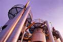
Lost Creek Gathering Co., L.L.C., formed earlier this year by Burlington Resources, Inc. and Enron Capital & Trade Resources Corp. is currently constructing a 127 mile, 24-inch diameter natural gas gathering system. The pipeline is expected to be able to deliver an additional 120 MMCFGPD from the Madden Field area into the Colorado Interstate GasCo and Wyoming Interstate GasCo pipelines without compression and approximately 275 MMCFGPD with compression. The completion of these facilities is expected during the second quarter of 2000 and will significantly enhance gas marketing capabilities out of the area.
Improvements in drilling and completion technologies have been the primary reason Burlington Resources and Barrett Resources has been successful in the prospect area. The universal use of downhole motors has been a major advantage. The current drilling plan drills to total depth at 14,800' in the Lance in 45 days, where in the past, the Lance was subjected to drilling fluids for 3 to 4 months during the drilling of a deeper test, causing almost irreversible formation damage. Burlington Resources has significantly reduced costs and drilling times on the Madden anticline. Composite plugs and foam frac technologies has lessened potential formation damage during completions and enhanced initial production rates Earlier 2-D seismic surveys across the Madden anticline and the Owl Creek thrust trend were next to impossible to accurately interpret due to extreme velocity problems caused by thousands of feet of gas saturated Upper Cretaceous and Tertiary Formations. and by velocity variations in the Waltman shale. The current state of 3-D seismic technology has led to drilling successes in this structural and stratigraphically complex area. Burlington Resources has completed a 68 square mile 3-D survey over the prospect area. Development drilling in the Madden Field continues to target potential pays from 6000' to the Madison at 23,000'. Advances in drilling technologies have reduced well costs. Modern 3-D seismic enhances reliability of interpretation resulting in increased exploratory success. These factors make the area an attractive development play with ultimate reserves ranging to 133 BCFG and 1 MMB condensate.
Prospects Click Baxter to see - Baxter Ranch - San Joaquin Basin, Kings County, California Click Bluff Bench to see - Southern Paradox Basin - Bluff Bench - Aneth Area, San Juan County, Utah Click Madden to see - Philp - Knapp Lease Madden Unit, Fremont County, Wyoming Click Owl Creek to see - Owl Creek Thrust Trend - Wind River Basin, Fremont County, Wyoming |
Dwight Ingram
303.726.5663 (cell)
Time in the Colorado Rockies
Updated: |
|||||||||||||||||
|
|
||||||||||||||||||
|
website
designed by YourWebGenie.com Favorite links: |
||||||||||||||||||