|
|
|
|
|
|||||||||||||||
Oil and Gas Specialist - Worldwide Consultant - 32 years experience - Based in Denver, Colorado |
303.726.5663
(Cell) |
|||||||||||||||||
|
|
|
|
|
|||||||||||||||
|
303.726.5663 (Cell) |
|
|
||||||||||||||||
|
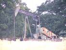
Owl Creek Prospect Noble Ridge
Unit
The OCT, LLC has assembled more than 23,000 gross/net acres along the Owl Creek thrust trend and Madden Field areas of the northeastern portion of the Wind River Basin, which are being offered for sale as an exploration and development opportunity. The Noble Ridge Unit consists of 23,682.31 acres adjacent to and north of the Madden Unit. A 15,000' Lance test is proposed as the initial required unit well to be located NENE-3-T39N-R90W. The required Unit well will need to be drilled after July 16, 2006 and before November 15, 2006, as defined by current lease and access road stipulations. The circuit, arcing geometry of the Owl creek thrust at the Noble Ridge, combined with a thick, south dipping subthrust stratigraphic section results in a potential Lower Ft. Union/Lance field approximately 8-10 miles long by 3 miles wide. Lance development drilling potential could reach more than 500 wells, based upon 40 ac spacing. An additional 14,800' Lance development well is proposed on a 386-acre fee lease within the Madden Unit Boundary. The Philp-Knapp No. 1-18, NWSW-18-T39N-R39W, targets 1090' feet of CNL-FDC gas pay found in an offset well, the Shelter No. 1-19. Completion of this development well will have an immediate economic impact. Air-mag and 2-D CDP seismic data confirm the low angled nature of the thrust which sets up a highly prospective subthrust fairway, which is 12-18 miles wide by 50-60 miles long and has been overlooked by previous exploration efforts. The Lance Formation in the northeast portion of the Wind River basin is approximately 5000' gross thickness with up to 2000' net sand. Both the upper and Lower Cretaceous section are expected to be geopressured up to a gradient of 0.55 psi/ft. Improvements in drilling technologies have reduced overall costs, drilling times, and reservoir damage, while the use of flow through composite frac plugs results in higher initial flow rates and ultimate gas reserves. Multiple subthrust gas prospect areas have been identified in this gas-rich, high economic impact area. These prospects utilize the Madden and Cave Gulch Fields as geologic analogs and could be further delineated with 3-D seismic surveys. Burlington Resources is presently permitting an approximate 60 square mile 3-D survey covering much of the Noble Ridge Unit Area. The submitted leases target exploratory potential for large subthrust anticlinal structures with potential reserves ranging up to several TCFG and multi-million barrels condensate from the Madison Formation as well as the shallower pays of the Shannon, Frontier, Mesaverde, Lance, and Ft. Union Formations
Oil and gas exploration in the Madden and Cave Gulch Field areas of the Wind River Basin dates back to the early 1950's. The Pure Oil, Badwater No. 1, was drilled to 11,143' on what was then termed the Badwater structure in 1949. The well was deepened in 1957 to 16,869' and tested gas from 223' of pay in the Lance Formation. The Field was later re-discovered in June of 1968 by Wolf Exploration by the drilling of the Madden Deep Unit No. 1, located NWSW-2-T38N-R90W. Madden Field is characterized by thrust fault bounded anticlinal geometry and gas production from multiple stratigraphic horizons of the Lower Ft. Union, Lance, Mesaverde, Shannon sands, and the Madison dolomite. The field covers more than 30 square miles and is located about six miles south of the surface trace of the north dipping Owl Creek Thrust. Severe seismic velocity variations which masked the true structural relief and formation damage caused by drilling and completion fluids, slowed initial continuous development of the field. Burlington Resources is the current operator of the Madden Field. Burlington has focussed their efforts on the prolific Madison dolomite, located at depths of 25,000'. Gas reserves for the Madison Formation are estimated to range between 2.6 to 4 TCFG, with net pay reaching 250' and a proven gas column of more than 1200'. Initial daily production rates per wellbore range from 40-50 MMCFGPD. These rates have been constrained due to processing capacity. These wells are capable of higher rates as calculated AOF's of more than 150 MMCF have been recorded. The Madison is currently producing 8-9 BCFG per month from 7 wells. This is about 300 MMCFGPD gross production from the Madison Formation., oran average 43 MMCFGPD per well. Produced gas from the Madison contains about 12% H2S and about 21% CO2. The remaining hydrocarbon content is essentially methane. Burlington has recently doubled the plant's gross inlet capacity from the 130 MMCFD to 310 MMCFD. The plant is presently in operation. Burlington Resources has improved Lower Ft. Union economics by employing a 100 well slim hole drilling program, targeting the uppermost 500' of the Lower Ft. Union formation. Utilizing a rig dedicated to slim hole technology, Burlington has realized cost reductions a now drills these wells in less than 7 days. Burlington has additionally focused their efforts on the Frontier formation and plans a pilot coalbed methane program in the Lower Ft. Union. The Lance has produced approximately 40 BCFG in the Madden Unit Area. The productive potential of the Upper Cretaceous was only in part understood. The Cody Formation was generally the target of earlier wells, and the Lance Formation was rarely tested. Fieldwide downdip limits have not been identified in the Cretaceous reservoirs. Presently, these sands have been the subjects of improved drilling and completion technologies as well as the advances in 3-D seismic acquisition and interpretation. Improved transportation out of the area has resulted in continued activity. The Bullfrog, Waltman, and Cave Gulch areas followed a similar development history. The Chevron Waltman No. 1 was drilled during 1959 to a total depth of 11,899' in the Cody Shale. Both the Lance and the Fort Union were found to be productive. Subsequent development drilling sporadically continued over the next 40 years continuing with the Barrett Resources Cave Gulch No. 1 discovery in December 1994. The discovery of the Cave Gulch Field has sparked a re-newed interest for Cretaceous subthrust targets along the footwall of the Owl Creek Thrust.
The assembled acreage is located on the northeast flank of the Wind River Basin in central Wyoming, approximately 90 miles northwest of Casper. It is located along the Owl Creek thrust on trend with Cave Gulch Field and within the boundary of the Madden Unit. The northeast flank of the Wind River Basin was also the depocenter for both the Fort Union and Lance Formations.
The Cave Gulch Field was discovered by Barrett Resources by the drilling of the Cave Gulch Federal No. 1 located NENE-31-T37N-R86W in Natrona County, Wyoming. The prospect was based upon the realization that the Waltman No. 1, SW/4-31-T37N-R86W, had produced more than 18 BCFG, but had never been offset to the northeast. The well was drilled north of the Waltman Field through the Owl Creek thrust into the Upper Lance Formation. The well encountered 481' net pay in a 2200' interval of the Lance and the Fort Union Formations. This well flowed 10 MMCFGD and has produced about 17.1 BCFG and 73.6 MBC from perforations in just 246' of pay between 5742 and 6811' through March 2002. Gas production for the Cave Gulch Federal No. 1 averaged about 900 MCFD during 2005 The Cave Gulch Unit encompasses just 440 acres. Continued development at Cave Gulch has resulted in successful completions in the deeper pays, including the Frontier, Muddy, Dakota, and Lakota Formations. The Muddy has huge potential as evidenced by the Cave Gulch No. 1-29, which blew out and produced up to 100 MMCFGPD through drillpipe to the sales line. Cumulative production has reached 13.6 BCFG from Muddy perforations at 18,154' to 18,204'. The offset, the Cave Gulch No. 3-29 tested up to 61 MMCFGPD from perforations at about 16,750' to 18,148' and production has totaled 14.3 BCFG. Moncrief has recompleted the No. 16-1 Teepee Flats, NESW-16-T37N-R86W for 8 MMCFGPD from the Muddy.
The Owl Creek thrust is an east-west trending low angle thrust fault that overrides the north flank of the Wind River Basin. The Owl Creek thrust fault and it's associated faults and en echelon folds dominate the prospect area. Detailed surface mapping indicates at least two periods of activity along the thrust. Northwest trending structures, which can be 6-10 miles long, predate a younger east-west trend. Northwest trending structures were uplifted during late Cretaceous and Paleocene time, while the east-west system was uplifted during the early-middle Eocene. The Owl Creek Range was uplifted and thrusted over the subsiding Wind River Basin during the Eocene and truncated the previously existing northwest trending structures, similar to features along the Casper arch. Horizontal displacement along the fault trend ranges from 12 to 18 miles Exploration efforts have previously focused upon anticlinal structures located in front of the surface trace of the Owl Creek Thrust, such as the Madden anticline. To date, there exists a 12-18 mile fairway beneath the thrust, which is 50-60 miles long and is virtually unexplored. Established gas production from the Fort Union, Lance, Frontier, and Muddy Formations at Cave Gulch, and from the Frontier and Muddy Formations at Tepee Flats prove the extraordinary potential of this prolific trend. Stratigraphy The Tertiary Lower Ft. Union, the Cretaceous Lance, Mesaverde, Frontier, Muddy and Mississippian Madison Formation are the primary targets in the project area. The NE portion of the Wind River Basins contains more than 26,000' of sedimentary section. Sandstone reservoirs of the Lower Ft. Union and Lance Formations are gas saturated throughout the Project area. The stacked fluvial sequences of the Lance and Lower Ft. Union are approximately 8400' thick where preserved and have an east-west trend. Lower Ft. Union sands immediately underlying the Waltman shale have been an important target in both the Madden and Frenchie Draw areas. The lower part of the Lower Ft. Union and Lance are described as interbedded lenticular sandstones and shales, ranging from 10-50' thick. These units generally exhibit gas effect on CNL-FDC logs. Log calculated porosities may reach 20% in the better-developed sands and natural fractures enhance reservoir permeability. X-ray diffraction analyses of the Lance at Cave Gulch field indicate the presence of kaolinite (31-55%), illite/smectite (10-49%), chlorite (13-28%), and smectite (8-14%). The Meeteetse Formation and the Lewis consist of interbedded sands, coals, and shales throughout the project area. These sands generally exhibit CNL-FDC gas effect where log porosity exceeds 8%. The Mesaverde is approximately 1200' thick at Madden and can be divided into three members. The uppermost unit is the Teapot sandstone. The middle member is usually non-productive and is a series of non-marine sands, shales and coals. The lowermost unit, informally named the Fales sand, is about 200' thick and is productive throughout the Madden area. The Fales sand is described as very fine to fine grained, calcareous, well sorted, and contains variable clay content. The Fales is interpreted to represent sands deposited in a prograding barrier bar environment. The original pressure gradient in the Mesaverde is 0.73 psi/ft. The Cody shale contains the Sussex and Shannon sands. The Shannon sands are described as two coarsening upward bar sands that range in thickness from 10-60'. Shannon reservoirs are geopressured to a gradient of 0.76 psi/ft. at Madden. Although many Shannon reservoirs appear to be tight based upon log analysis, the zones have produced significant volumes of gas due to reservoir enhancement due to naturally occurring fractures. The Upper Cretaceous Frontier consists of a series of coarsening upward, lenticular sequences ranging up to 20' thick. Log porosities can be 15%. Mudlog gas shows are common in the Frontier at Madden. The Muddy sand has been a very important producer at Cave Gulch Field, and flow tested gas at Hells Half Acre. It is believed that a Muddy thick extends across the northeastern area of the Wind River Basin. The Mississippian Madison Limestone was deposited on a broad shelf and is about 400' thick. It consists of interbedded limestones and dolomites with occasional ooilitic grainstones. Net pay can reach 250'.The Madison is more dolomitic eastward along the Owl Creek Mountains. The Madison dolomites at Madden are found at 25,000' drill depths and display porosity up to 15%.
The Noble Ridge Unit contains 23,682.31 acres. The proposed well will play off the structural style of the Owl Creek thrust system where the primary thrust has overridden the northwestward continuation of the Badwater anticline. The relatively low angle of the Owl Creek thrust fault leaves room for both Upper & Lower Cretaceous strata through the Madison underlying the thrust. The initial required test well is located along the leading edge of the Owl Creek thrust, analogous to the Cave Gulch Field. A 15,000' Lance test is proposed for the NENE-3-T39-R90W. The location will test an approximate 7500' thick series of Lower Ft. Union and Lance sands, which dip south and flatten into the leading edge of the Owl Creek thrust. This section should be as complete as the Lower Ft. Union and Lance sections located at the Madden Field. This is analogous to the published 2-D seismic lines that were utilized in the original Cave Gulch field seismic interpretation.
The Philp-Knapp lease is located in Sections 7, 13, &18-T39N-R90-91W within the Madden Unit Area. Structural mapping utilizing subsurface data at the top of the Lance indicates that the proposed location will test a series of Lower Ft. Union and Lance sands on the north flank of the Madden Unit. The Lower Ft. Union and Lance Formations are gas saturated yet only sparsely tested in this area of the unit. Review of the available seismic data in the area indicates the presence of possible deep-seated faulting en echelon to the Madden anticline and primary Owl Creek thrust fault. Review of aerial photomap data indicates a deep-seated structural feature north of the Shelter No. 1-19. Correlation of individual sands in the fluvial section of the Lower Ft. Union and Lance is impossible even at 40-acre spacing. Gas recoveries indicate the presence of a much larger gas reservoir. Natural fractures associated with east-west trending faults and vertical and lateral variations in sandstone deposition have compartmentalized a large gas accumulation along the north flank of the Madden anticline. Monsanto drilled the Shelter 1-19, NWNW-19-T39N-R90W, on February 5, 1979 and completed the test March 31, 1980 from perforations in the Shannon at 18,790-19,253'. The well was fraced with 229,000 gal water, 250,000 # sand, and flowed 1,200 MCFGPD and produced 56,680 MCFG + 7,881 BW. Last production from the well occurred in 1980. During the late 1970's and early 1980's the Shannon sands of the Cody Formation were the primary targets at Madden. Over the past several years, the emphasis has focused more on the Lower Ft. Union sands, the Lance, and the deeper Madison Formation. Analysis of the Density-Neutron log indicates that numerous gas-saturated sands are behind pipe. The Shelter No. 1-19 logged 61 pay sands in the Lower Ft. Union and Lance identified by gas effect occurring on the Density-Neutron log combined with an 8% porosity cut-off. Thickness of net pay sands in the wellbore totaled 1090'. Thickness of individual sand bodies ranged from 4-54' and averaged almost 18' per unit. Porosity in the sands ranged from 8-13%, with a few sands in the 14-16% range. Mud log gas shows over these same intervals indicate a gas saturated section.
Drilling of the Shelter No. 1-19 took more than a year to reach total depth. Sands of the Lower Ft. Union and Lance Formations were likely damaged by the length of time the drilling fluids were on the formation. Wells were completed with sand and water fracs during this era resulting in additional damage to the reservoir. Today, wells are drilled in 3-4 weeks and completed with inert gas foam fracs and sand. Burlington Resources has completed the MDU No. 8-23, SWNE-23-T39N-R91W, in June 2003, flowing naturally at 3.3 MMCFGPD from perforations at 6882-90', 6908-12', and 6926-30'. These sands directly underlie the Waltman shale that has been the target of Burlington's most recent activity. Log calculated porosities are in the 14-16% range. This well is arguably the best well in Burlington's 50 well shallow Madden Unit drilling program. Burlington Resources recompleted the Mesa-Federal No. 1-14, SWNW-14-T39N-R91W in several zones within the Lance below 15,000'. The well flowed 1060 MCFGPD + 53 BWPD from Lance perforations at 15,010-020', 15,072-082', 15,168-180', 15,250-282'. This well is about one mile west, and it is approximately 1000' structurally low to our proposed location. The Mesa Federal was originally drilled to the Cody in November 1980 and completed for 60 MCFGPD from perforations at 20,048-20,212'. There was no known production reported from the Cody. Petrophysical analysis of the Density-Neutron log indicate 978' gas pay in 55 zones in the Lower Ft. Union and Lance Formations. Double Eagle Petroleum has completed their Allen Deep No. 1, located SENW-26-T39N-R90W, for 3.5 MMCFGPD from the Lower Ft. Union Formation. The well was drilled to a total depth of 12,150'. High pipeline pressures of over 1,100 psi had initially restricted production rates. Cumulative production has totaled about 500 MMCFG from perforations in thin Lance sands. This extends the Lower Fort Union production one mile north of Madden Fields previously known limits. Double Eagle has offset the Allen Deep No. 1 with the Lloyd No. 1-26, NWNE-26-T39N-R90W, drilled to total depth of 7225' on August 5, 2000. Mud log shows in sands of the Lower Ft. Union immediately underlying the base of the Waltman shale indicate productive potential. This well is waiting on a frac. The Barrick No. 1-24 Leonard, located NWNW-24-39N-90W, was completed in January 1984 flowing 3881 MCFGPD from perforations at 14,628-14,688'. Cumulative production totaled 867 BO + 538,156 MCFG + 2,987 BW. Date of last production was mid-1997 while the well was being operated by KCS Mountain resources. This well had numerous mud log gas shows, flowed gas during drillstem testing, and exhibited Density-Neutron log gas effect throughout several zones in the Lance and Fort Union Formations. It is important to note that this test, if drilled using current drilling and mud engineering technologies, could be drilled in less time than the 110 days required in 1984. The numerous zones having similar petrophysical characteristics as the Barrett Resources Cave Gulch discovery could be completed using state of the art frac technologies resulting in large volume gas production. Double Eagle acquired the Leonard No. 1-24 and flowed gas at rates of more than 2 MMCFGPD from 13,300' during June 2000 workover. A drillstem test of the Lower Ft. Union in the Leonard No. 1-24 from 7,128-7,229' flowed gas at a rate of 2,272 MCFGPD. This indicates a gas column of more than 1500' ranging more than 8 miles long, at least as far west as the Mesa-Federal No. 1-14, and without an identifiable gas-water contact. Several key wells also indicate the potential of the Madden anticline off what is believed to be the anticlinal axis. The Pure Oil, Badwater Unit No. 1, located NENW-35-39N-89W was completed in November 1957 flowing 5500 MCFGPD on 1/2" choke from perforations at 15,216-16,472'. Unocal relogged the well with a TDT tool 20 years after the initial test. The TDT tool logged 22 zones displaying gas effect between 12,300-14,150'. The Moncrief Badwater Creek No. 1, located SWNE-12-38N-89W, drilled by Moncrief in 1991, was originally set up as a 24,500' Madison test. This test is located about 12 miles east of our proposed location on the easterly plunging nose of the Madden anticline. Due to the unexpected thickening of the upper formations, drilling operations ceased at 20,080' in the Cody Shale. Production casing was run to a plug back depth of 14,600'. Completion data from March 30, 1991 reports an IP of 1,790 MCFGPD from perforations at 13,926-14,022. No frac treatment has been reported. This well is reported to have had 26 zones exhibiting gas effect on the Density-Neutron log between the depths of 11,150 and 14, 050'.
The Birdseye Creek Prospect is characterized as a subthrust Lower Cretaceous and Mississippian Madison plays. The play is set up by the CIG Exploration No. 1-4-39-94, located NWNE-4-T39N-R94W. The well was spudded October 1978 and drilled to a total depth of 17,550' in the Cody. A drillstem test from 15,575-886' flowed gas to surface in 206 minutes at 1300 MCFGPD. Times and pressures are described as: op 426, SI 137, op 71, SI 361, 1200' WC, FP: 9,146-11,326, 5557-5209, SIP: 8254-8254, HP: 12,252-12,380. A drillstem test from 15,637-886' flowed gas to surface at 1,100 MCFGPD. Dipmeter analysis of this well indicates 45-50 degree south dip beneath the thrust cut at about 6140'. The play is fortuitously located in a crestal position on an anticlinal feature bounded by the CIG well on the south flank and postulated rollover in the Owl Creek thrust. Mapping of the air-mag indicates a basement structure approximately 2 miles wide by four miles long. Total depth for a Mississippian test will be in the 17,500' range. The Birdseye Creek area has multi-TCF Madison potential at moderate drilling depths.
Lost Creek Gathering Co., L.L.C., formed by Burlington Resources, Inc. has completed construction a 127-mile, 24-inch diameter natural gas gathering system. The pipeline is expected to be able to deliver an additional 120 MMCFGPD from the Madden Field area into the Colorado Interstate GasCo and Wyoming Interstate GasCo pipelines without compression and approximately 275 MMCFGPD with compression. The completion of these facilities has enhanced gas-marketing capabilities out of the area. The completion of the Kern River expansion and the approval of the Cheyenne Plains project to move gas eastward has resulted in a closure of the Rockies basis differential and overall higher gas prices. Summary Improvements in drilling and completion technologies have been the primary reason Burlington Resources and Barrett Resources has been successful in the prospect area. The universal use of downhole motors has been a major advantage. The current drilling plan drills to total depth at 15.000' in the Lance in 65 days, where in the past, the Lance was subjected to drilling fluids for 3 to 4 months during the drilling of a deeper test, causing almost irreversible formation damage. The use of flow through composite plugs allows gas to flow up the wellbore while testing additional zones without having to kill the well with water. These plugs are set with wireline resulting in rigless completions, further reducing costs. Earlier 2-D seismic surveys across the Madden anticline and the Owl Creek thrust trend were next to impossible to accurately interpret due to extreme velocity problems caused by thousands of feet of gas saturated Upper Cretaceous and Tertiary Formations and by velocity variations in the Waltman shale. The current state of 3-D seismic technology has led to drilling successes in this structural and stratigraphically complex area. Burlington Resources has completed a 68 square mile 3-D survey over the prospect area. Development drilling in the Madden Field continues to target potential pays from 6000' to the Madison at 25,000'. Advances in drilling technologies have reduced well costs. Modern 3-D seismic enhances reliability of interpretation resulting in increased exploratory success. These factors make the area an attractive development play with ultimate reserves ranging to 220.4 BCFG and 1 MMB condensate. Formation of the Noble Ridge Unit is a key strategy as it
allows us to: 1) Manage and ultimately maintain our lease position 2) Control the pace of Lance development drilling as Unit operator 3) Acquire appropriate velocity, geological, and geophysical data to further define a subthrust Madison drilling location.
Prospects Click Baxter to see - Baxter Ranch - San Joaquin Basin, Kings County, California Click Bluff Bench to see - Southern Paradox Basin - Bluff Bench - Aneth Area, San Juan County, Utah Click Madden to see - Philp - Knapp Lease Madden Unit, Fremont County, Wyoming Click Owl Creek to see - Owl Creek Thrust Trend - Wind River Basin, Fremont County, Wyoming |
Dwight Ingram
303.726.5663 (cell) Time in the Colorado Rockies
Updated:
1. Economic Summaries 2. Shelter No. 1-19 Petrophysical Summary Spreadsheet 3. Shelter No. 1-19 CNL-FDC "Gas Effect" Log Example 4. Shelter No. 1-9 Mud Log Gas Show Summary Spreadsheet 5. Shelter No. 1-19 Mud Log: Lower Ft. Union Gas Show 6. State No. 1-16 Petrophysical Summary Spreadsheet 7. Mesa- Fed No. 1-14 Petrophysical Summary Spreadsheet 8. Well Data Map with L. Ft. Union Structure Contours 9. Lower Ft. Union Strat Cross-Section Example 10. Net Gas Pay Isopach Map 11. Coastal Letter & Gathering Lines Map 12.Map: Lost Creek Gathering System
Time in the Colorado Rockies
Updated: |
|||||||||||||||||
|
|
||||||||||||||||||
|
website
designed by YourWebGenie.com Favorite links: |
||||||||||||||||||